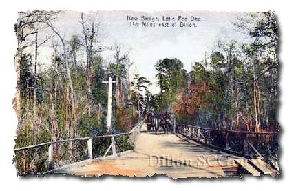
THE BRIDGES OF DILLON COUNTY
McInnis Bridge - Hwy 57, northern Dillon County
crosses the Little Pee Dee River close to NC state line. If you look at a map, you'll
see McInnis' Bridge at the very top of Dillon County, slicing through the triangular area between the
North Carolina state line and Marlboro County.
Location on map
McKays Bridge - Rte. 429, northern Dillon County
crosses the Little Pee Dee River close to the NC state line, near Shoe Heel Creek
Location on map
Hamers Bridge - Route 23, northern Dillon County
crosses Little Pee Dee River slightly NE of Little Rock
Location on map
Stafford Bridge - central Dillon County
NNE of Dillon, crosses Little Pee Dee River near juncture of Hwy 301 and 40
Location on map
Dillon Bridge - Hwy 9, central Dillon County
crosses Little Pee Dee River east of Dillon (town)
Location on map
Huggins Bridge - Hwy 41
crosses the Little Pee Dee River about half way between Kemper and Fork
(Buck Swamp area)
Location on map
Allens Bridge - Rte. 72
crosses the Little Pee Dee River SE of Fork near the Marion County line
Location on map
|

